Baie du Mont-Saint-Michel
France · France métropolitaine
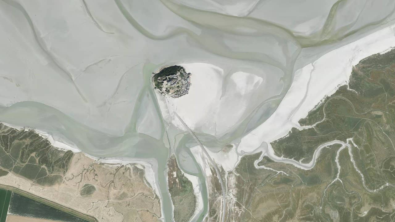
The Bay of Mont-Saint-Michel, located in Normandy at the foot of the famous Mont, offers a spectacular landscape with its vast sandy expanses at low tide and its rapidly rising water. It is a kitesurfing spot in a sheltered bay, appreciated for its proximity to major tourist sites.
The wind here is often capricious due to the bay's configuration, but it becomes more consistent with strong north-west winds. Local riders mainly navigate around high tide to take advantage of the navigable space.
Easy access from surrounding roads, with parking nearby, but one must watch the tide schedules to avoid being caught by the rising waters.
Medie storiche per mese — non è una previsione live.
The bay generally orients north-south, with an entrance exposed to winds from west to north-west which are the most favorable, arriving in side-on or side-shore from the left of the beach. East or south-east winds are rarer and turbulent due to the enclosure. The water surface is highly dependent on the tides: at low tide, the bay almost completely empties, leaving only sandbanks and little water, making navigation impossible except on a few residual channels. At high tide, the water covers a large area, providing a flat space to navigate up to several hundred meters from the shore.
Launching is done directly on the sandy beach, wide and clean, with take-off on the grassy area at the top of the dunes when possible. The main navigation area is in the center of the bay, avoiding the areas around the Mont where currents are strong. In strong NW winds, the wind accelerates in the bay but remains capricious in gusts if the wind is weak; stay offshore to avoid lulls near the shores. Ideal sessions last 2 hours before and after high tide, especially with medium to high coefficients for more water.
Local peculiarity: the bay is immense (the largest in Europe), with quicksand and murky water; kitesurfing is mainly practiced near Le Mont-Saint-Michel or towards Saint-Jean-le-Thomas, but be cautious of tourists and foot fishing areas.
Fonti :spots.guru · emeraudekite.com · kitetrip-planner.com · thespot2be.com · fr.windfinder.com