Plage des Chardons
France · Pays de la Loire
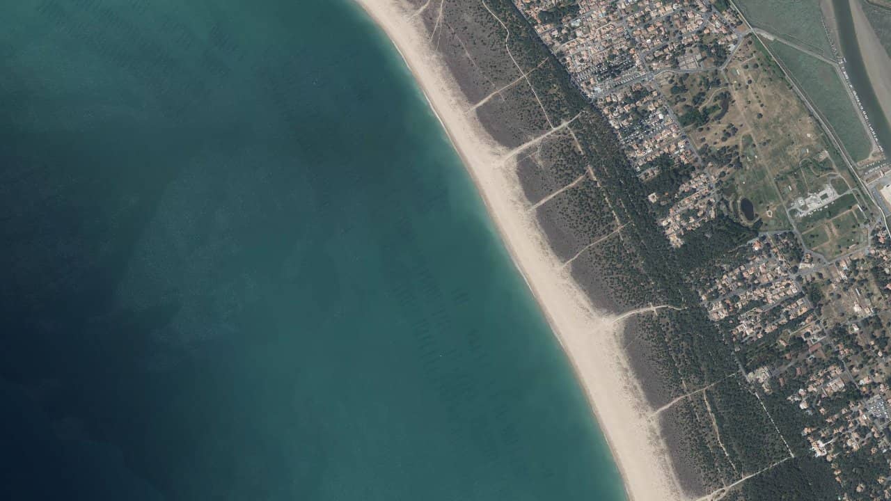
Chardons Beach, on the L’Aiguillon peninsula, is a large sandy beach facing the Atlantic. It stretches to the south of the resort, in a still quite preserved environment, between dunes and ocean.
In summer, the beach is rather family-friendly, but as soon as the wind picks up, it also attracts some enthusiasts of sliding sports. The setting is simple, functional, with direct access to the ocean and a wide sandy area to set up and prepare your equipment.
Historical averages by month — not a live forecast.
The beach is generally oriented west/southwest, with the ocean directly in front. A wind from W to NW usually arrives side-on to the beach, which remains the most comfortable configuration for practice. With a SW wind, the wind becomes a bit more onshore, with a quickly choppy water surface. Too offshore orientations (E, NE) are not suitable here without boat safety.
The water surface is completely open, without a sandbank like a lagoon offshore as at Pointe d’Arçay. At mid-high to high tide, there is a more pronounced shorebreak, with disorganized waves that complicate entry, especially for the less experienced. At mid-falling tide, the water surface becomes a mix of chop and small waves that can be interesting for surfing or strapless, but there is no real flat area. The swimming area is monitored in summer and marked, so you must stay outside this area with a kite to avoid disturbing swimmers.
Takeoff is done on dry sand, taking advantage of the wide beach. It is preferable to take off far from the swimming area and the main access points, positioning oneself slightly back to limit risk in case of gusts. Entry is done directly in the waves, without significant walking or reported rocks, but with a shorebreak that can be powerful on days with swell. There is no specific marked kite channel, so one must be very vigilant about cohabitation with swimmers and other users.
Local peculiarities to keep in mind: it is a beach rather “pure ocean”, without a secure flat water area like some lagoons in southern Vendée. The local schools often prefer more sheltered sandbanks accessible by boat for teaching. Here, we ride in the open sea with a lively water surface, ideal for riders already comfortable in waves and chop. On days of high coefficients, the tide reveals more of the beach, but does not create a truly exploitable lagoon for kiting.
Sources :vendeedusud.com · vendeedusud.com · campinggrandr.fr · kitesurfvendee.fr · camping-la-siesta.com