Plage du Grignon
France · Nouvelle-Aquitaine
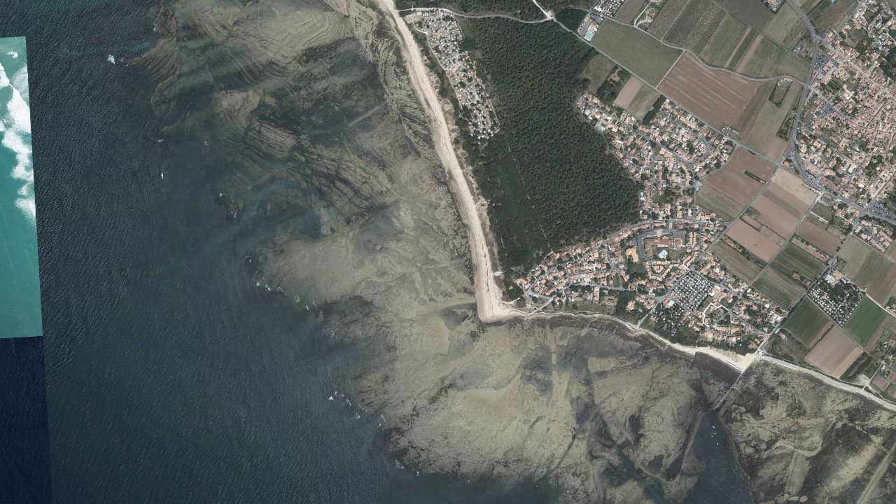
The Grignon beach, at the western end of Ars-en-Ré, is located at the end of a small road that leads between pines, dunes, and salt marshes. You arrive via a parking area set back, then a path allows you to cross the dune before emerging onto a rather wild beach facing the open sea.
The spot is known for its point, the Grignon point, which is very exposed to swell and west wind. It is a place appreciated by surfers, windsurfers, and experienced wingfoilers, with a rather local and sporty atmosphere, especially on days of big swell.
Historical averages by month — not a live forecast.
The Grignon spot faces the open sea, with a coastline generally oriented east-west. With wind from west to northwest, the wind mainly arrives side-shore to side-on from the right, providing good navigation conditions while maintaining a natural return to the beach. With southwest wind, the wind becomes more onshore and the waves are more disordered, while with northeast wind the water surface is often choppy but less clean for wave riders.
The Grignon point is described as a very exposed to swell area, without protection, with sometimes powerful waves, especially when the swell comes from the west. The waves are known to be hollow and more intense in winter, which explains why the spot is frequented mainly by experienced surfers, windsurfers, or wingfoilers. For kitesurfing, the open character, the shorebreak, and the presence of rocks at low tide make it a spot to approach with caution.
The beach is truly usable at mid to high tide. At low tide, the sea retreats far and many rocks are exposed in front of the beach, making launching complicated and uninviting. At high tide, there is a water area in front of the beach with a mostly sandy bottom, but there are still scattered rocky areas towards the point. The best compromise for navigation often occurs around mid-rising tide, when there is enough water to cover some of the rocks while maintaining beach width for launching.
The water surface is generally wave-formed: crossed swell or wind waves, with a shorebreak that can be marked, especially on days of big west swell. Practitioners mention a shorebreak that can be very powerful in this area, even if the waves remain technically "manageable" for a good level. Further offshore, there is a more open water surface where it is possible to extend the runs in wave freeride, but one must keep an eye on the wind direction and the current offshore.
The launching area is from the sandy beach, generally in front of the non-rocky part, moving away from the most rocky point at low tide. The launching and landing of the kite are done at the top of the beach, which is not huge but sufficient outside of heavy summer crowds. In summer, coexistence with bathers requires moving towards less crowded areas, closer to the point and outside of monitored zones.
Locally, the Grignon point is mainly cited as an engaged wave spot, compared to other easier spots on the island for kitesurfing (Rivedoux, Boutillon, Gros-Jonc, etc.). The spot is more suited for intermediate to advanced riders looking for sessions in the waves, with a minimum of ease to manage shorebreak, rocks at low tide, and currents.
Sources :plages.tv · magazine.sportihome.com · campinglesgrenettes.com · guide-charente-maritime.com · realahune.fr · directwind.com · thespot2be.com