Kiteloopers - Kitesurfing spots, trips and destinations worldwideKiteloopers - Kitesurfing spots, destinations and kite trips worldwide
MapDestinationsBlog
Log in

Projekt

  • Über uns
  • Kontakt

Rechtliches

  • Bedingungen
  • Datenschutz
  • Cookies
  • Impressum
  • Support

Community

  • Spots
  • Blog
  • Schulen
  • Lehrer
  • Unterkünfte
  • Reisen
  • KiteMarket

Soziales

  • Instagram
  • Facebook
© 2026 Kiteloopers — Alle Rechte vorbehalten
Queens

Queens

Rockaway Beach

États-Unis · New York

Mittel
Jan → Apr
22.2 kn
↓ Flach
↑ Flach

Queens

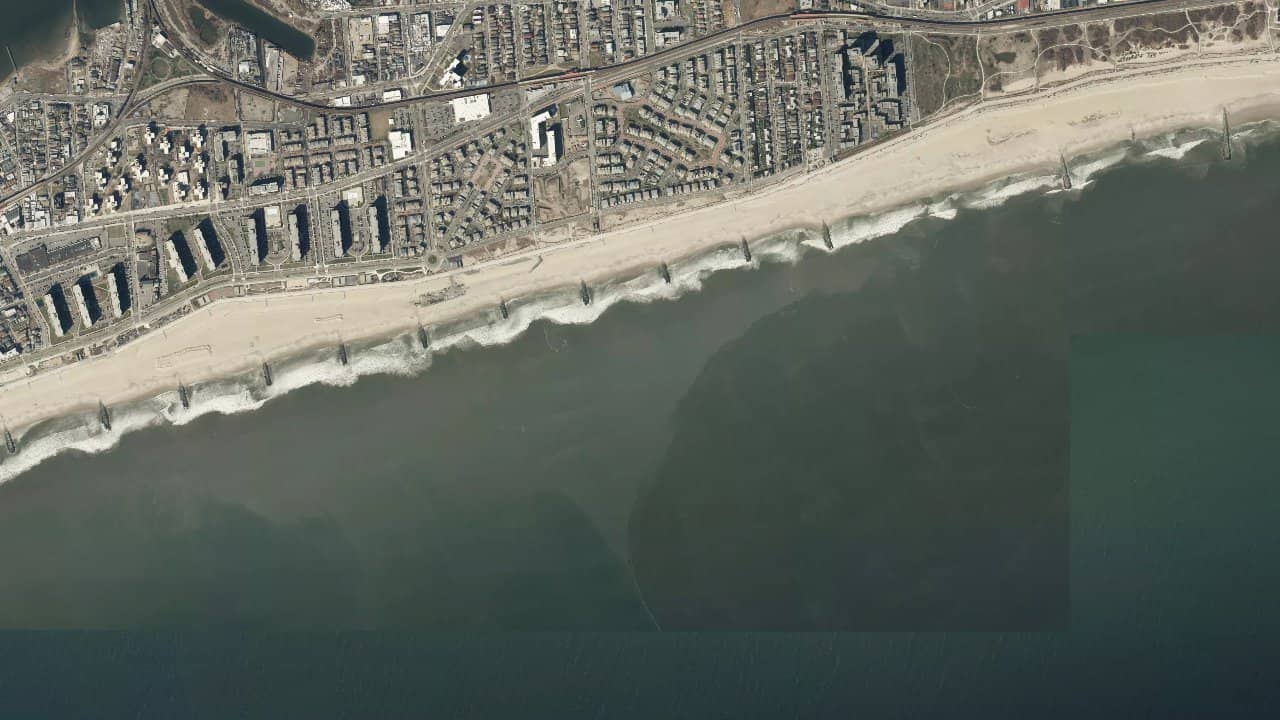
Rockaway Beach, located on the South Shore of Long Island in the Queens neighborhood of New York, is the largest urban beach in the United States. It is a seasonal spot favored by local riders for its balance between accessibility and wind quality, and it is also known as the 'Irish Riviera' due to its Irish-American population.

The beach offers a unique setting with its vast stretches of sand and laid-back atmosphere. It is a special place, both authentic and refined, where the thermal winds from the ocean combine with groundswells to create interesting conditions.

Live-Wind & Vorhersage

Windy

Klimastatistiken — Monatsmittel

Historische Monatsmittel — keine Live-Vorhersage.

Standort

Detaillierte Informationen

The ideal wind direction comes from the northwest (NW), generating side-shore winds parallel to the beach, perfect for kitesurfing. The spot features a mix of groundswells and wind swells, with the best swell direction coming from the east. Navigation areas include vast knee-deep bays extending for several kilometers, offering flat waters and ideal thermal winds for beginners. The launch area is directly on the beach, with easy access from streets like Beach 9th Street to Beach 149th Street. Local features include the presence of daily lifeguards from 10 AM to 6 PM during the season, and closed sections for safety or protection of nesting habitats.

Auf der Karte ansehen
Mobile app

Kiteloopers in your pocket

Spots, live weather, sessions & community.

Scan to download the app

App StoreGoogle Play

Risiken & Sicherheit

  • Rocks are exposed in the northern area, to be avoided for safety.
  • The current can be strong near the channel, requiring special attention.
  • Closed sections for safety or protection of nesting habitats are marked by signs and red flags, to be strictly observed.

Segelbedingungen

Flut
Wassertyp
flat
Tiefe
Stehtief
Befahrbarkeit
Ja
Ebbe
Wassertyp
flat
Tiefe
Stehtief
Befahrbarkeit
Ja

Idealer Wind

SOSSEENESO

Spots in der Nähe

Auf der Karte ansehen

Lädt…

Bewertungen der Kitesurfer

Chargement des avis...

Quellen :57hours.com · xtremespots.com · nycgovparks.org

← Zurück zur Suche
Auf der Karte ansehen