Havre de Portbail
France · Normandie
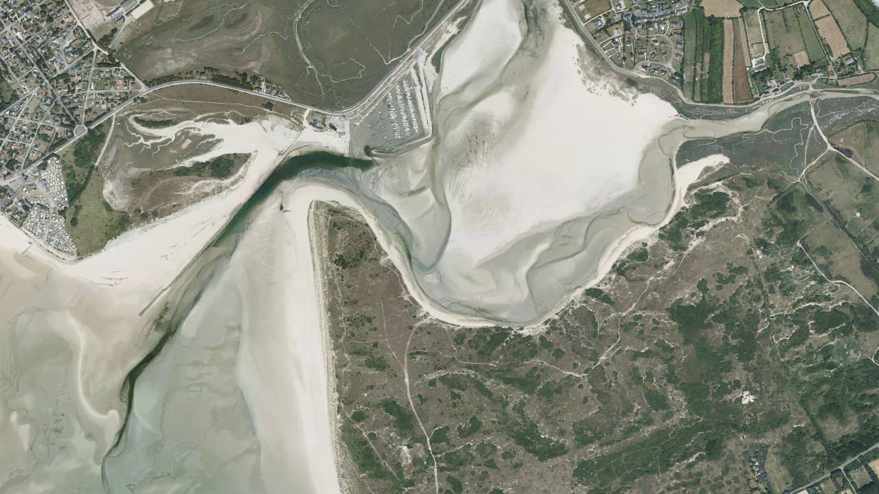
The lagoon of Portbail, located in Normandy on the west coast of Cotentin, offers a sheltered and accessible body of water just a few minutes from the village of Portbail-sur-Mer. It is a spot frequented by locals and suitable for beginners as well as practitioners looking for flat water to work on maneuvers and foiling. The lagoon mainly fills at high tide and is largely exposed at low tide, providing two different atmospheres for sessions.
At the mouth and the adjacent shallow estuary, small waves and more choppy areas can sometimes be found when the wind comes in strong from the sea. The launch area is simple from the sandbanks and grassy areas near the port parking lot, making it a practical spot for lessons and short outings. Portbail remains a quiet place with a local offering of schools and services related to water sports.
Historische Monatsmittel — keine Live-Vorhersage.
The dominant wind is generally from the West to Northwest, which usually gives a side-shore to side-on wind relative to the lagoon depending on the local shoreline alignment. The lagoon is sheltered and remains mostly flat at high tide, while at low tide exposed sandbanks create shallow areas and narrow water veins.
Launching is easy from the sandbanks and grassy areas near the port and the small municipal parking lot. There are wide navigation areas in the central part of the lagoon, ideal for beginners and teaching, and a more open area at the mouth where the water can become more choppy when the swell comes through.
It is advisable to avoid muddy areas and seagrass close to the low shore at low tide. The river mouth can generate some chop and a small jumpable wave when the wind is strong and blowing onshore from the sea. Local schools usually organize lesson areas near the most sheltered entrance for safety and pedagogical reasons.
Quellen :letskite.fr · web.kite-and-windsurfing-guide.com · se.kiteforum.com · wind-forecast.kite-normandie.fr · spotkitesurf.com