Anse du Croc
France · Bretagne
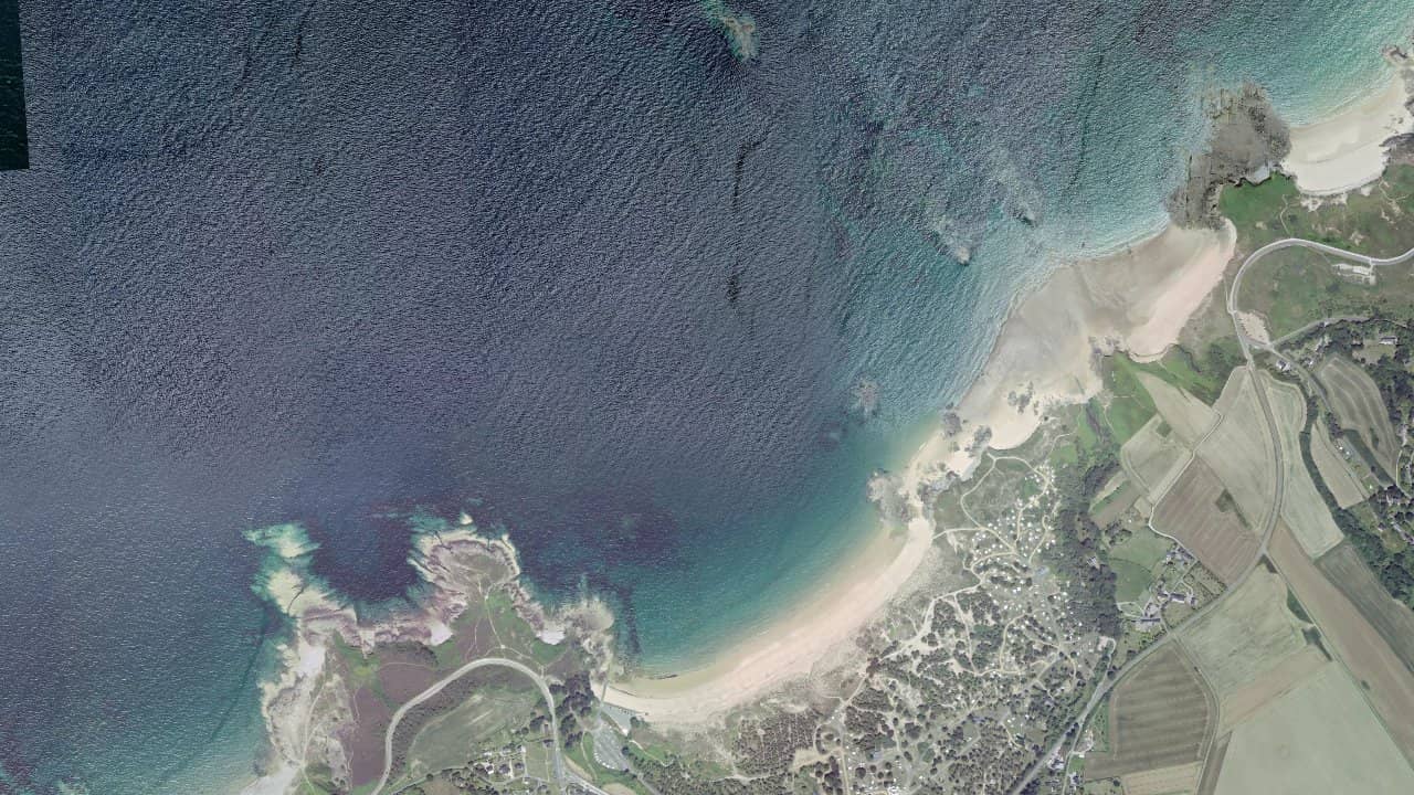
The beach of Anse du Croc in Pléhérel-Plage, in the municipality of Fréhel in Brittany, is a wild spot with an exceptional view of Cap Fréhel. Crescent-shaped over 800 meters, it is bordered by the GR34 and leads to the camping site of Pont de l'étang in a Natura 2000 area.
It is a popular place for surfing and mentioned as a kitesurfing zone, in a preserved setting of the Côte d'Émeraude. The atmosphere is mystical with its dunes and sometimes difficult access, ideal for nature lovers.
Monitored in July-August, it offers parking and a snack bar in season, perfect for a session after a coastal hike.
Historische Monatsmittel — keine Live-Vorhersage.
The beach of Anse du Croc is oriented northwest, making it ideal for northwest and west winds in side-on or side-shore from the right side of the beach, favoring stable navigation. The water entry is directly from the crescent-shaped sand, with a wide take-off area in the center avoiding the rocks on the sides. The navigation area extends in front of the beach towards the open sea, but remains limited by the rocky plateau that emerges at low tide.
At high tide, the water surface is more navigable with space to maneuver, even with a high coefficient, while at low tide, the rocky plateau emerges and reduces the safe area, making navigation technical. The north-west swells generate waves suitable for surfing, creating a water surface from chop to wave depending on the wind strength. Be careful of the lateral areas where the rocks complicate back and forth movements.
Local peculiarity: proximity to Cap Fréhel which can accelerate the wind in side-off by strong northeast winds for experienced riders. Avoid sessions with direct onshore winds from the south which make the spot exposed and choppy.
Quellen :armorsurfschool.com · frehel.info · tourismebretagne.com · cap-erquy-cap-frehel.n2000.fr · plages.tv