La Pointe d’Agon
France · Normandie
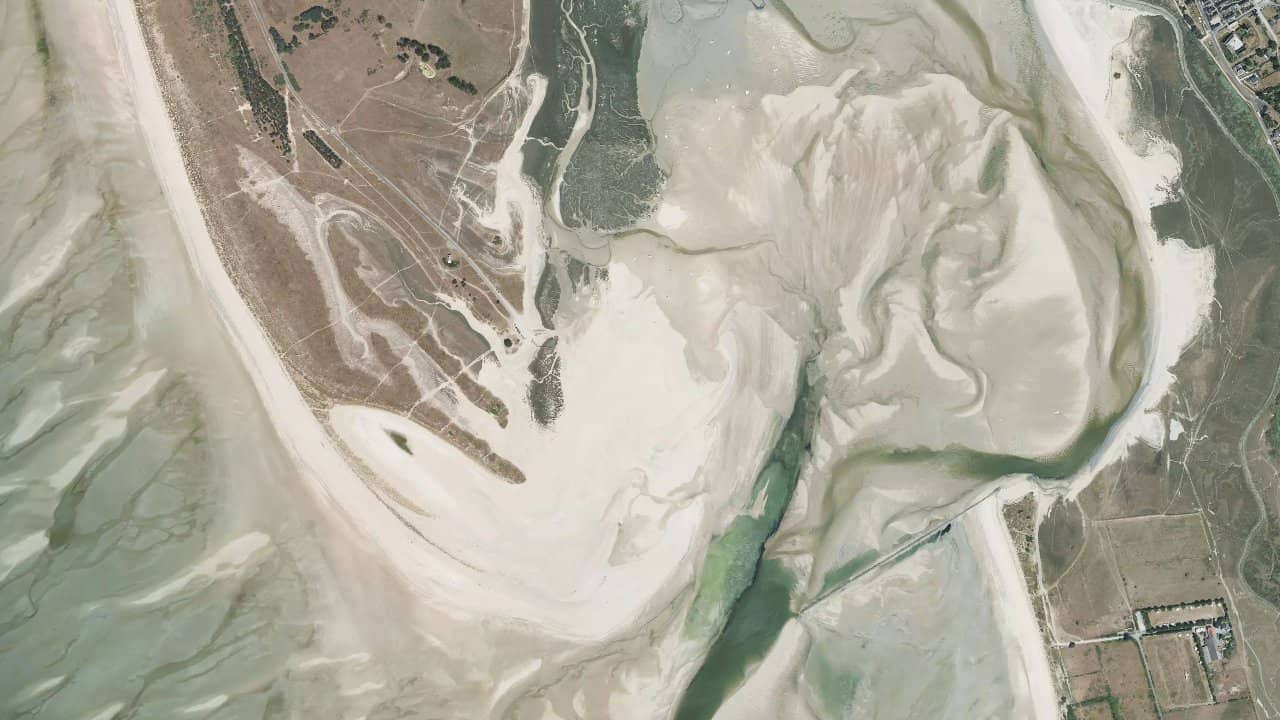
The Pointe d’Agon beach in Agon-Coutainville is the wildest beach in the region. It is located in a protected area by the coastal conservatory, near the harbor of Regnéville. The main access is through the Moulinière slipway, also used by shellfish farmers.
At low tide, the sea retreats very far and the oyster and mussel beds, rich in seafood, are revealed. The southern part of the beach has been reserved for naturists since 2014. The beach stretches for several kilometers to the north, accessible only on foot via a path.
It is a freeride kitesurfing spot, with a water area protected by the point itself, ideal for sailing quietly.
Historische Monatsmittel — keine Live-Vorhersage.
The spot works well with winds from south to north, with a relatively flat water area thanks to the protection of the Pointe d’Agon and the harbor of Regnéville. With strong west winds, it becomes side-on with some small waves, perfect for freeride. The west wind is side-shore from the Moulinière slipway, while the south provides offshore flat conditions.
Launching from the slipway, there is a take-off area on the wide beach at high tide. Navigation in the bay facing the point, but be careful to stay away from the mussel beds visible at low tide. With high coefficients, low tide = hassle with little water, rocks, and exposed bottom for hundreds of meters; high tide offers more space and depth.
Moderate current from south to north, more pronounced near the harbor entrance channel. Areas to avoid: mussel beds and areas too close to the shore at low tide. Ideal for windsurfing, wing, and kite, with space for 10 riders max without crowding.
Quellen :plages.tv · thespot2be.com · spots.universkite.fr · zoomkite.com · sportihome.com