Pays-Bas
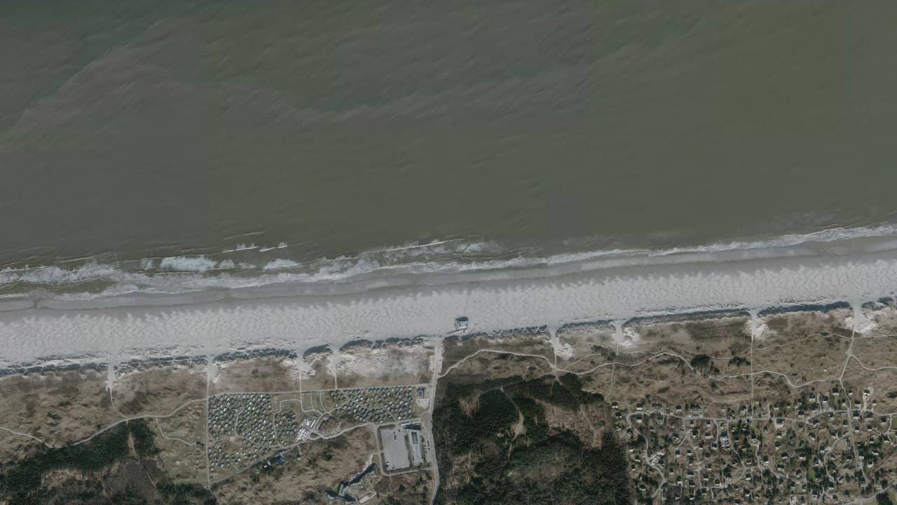
Strand Nes Noordzee is the northern spot of Ameland, on the North Sea coast, with a large open beach and a very natural setting. It is a spot known for its waves, its navigation space, and a fairly calm atmosphere off-season.[2][3][5]
The area is mainly used by riders looking for more challenging conditions than on an inland water body. Access is clear, but navigation requires strict adherence to the authorized area and the beach sector limits.[1][2][7]
The spot is interesting when the wind comes well from the west to northwest, with a wide beach that provides space to prepare and launch. However, it is not the easiest place for beginners, as the current, waves, and local rules require attention.[1][3][5]
Les données de vent affichées ici proviennent d’ERA5 (via Open-Meteo) sur 4 ans, retraitées pour refléter des conditions réalistes.
👉 Le vent moyen a été calibré pour éviter la sous-estimation habituelle des modèles.
👉 Les rafales ont été corrigées par un ratio médian afin d’éviter des valeurs extrêmes irréalistes.
👉 Chaque jour est résumé par le vent médian (P50) observé pendant les heures utiles (8h–20h), puis classé dans des plages de vent.
👉 Le mode pondéré mélange vent moyen et rafales pour refléter au mieux le vent ressenti.
The wind mainly works in side-shore to side-on depending on the flow orientation, with the best orientations around NW and W, sometimes N according to local sources.[3][4][10] The spot is exposed to the North Sea, so the water conditions change quickly with the swell and tide, and one must accept more powerful conditions than on a lagoon.[3][8][9]
The official navigation area on the Noordzee side is located between the authorized beach markers, with a wide portion around Nes and Ballum clearly framed by the municipality.[2][7] Access is via the local beach exit, extending from Westerpad, and launching must remain within the authorized sector, without leaving the marked area.[1][5]
At low tide, the beach becomes wider, but the spot remains an open sea site with waves and current. At high tide, the usable space may shrink, and conditions become more technical, especially if the wind is strong and the swell is well established.[1][3][8]
Launching takes place on a large beach, but it is important to keep a clear area to avoid interfering with other users or leaving the authorized perimeter. In practice, the spot requires being self-sufficient, monitoring one's trajectory, and staying attentive to beach markers and prohibited areas.[2][5][7]
Ideal conditions are a wind from NW to NE, with enough pressure to hold a kite of 7 to 9 m² depending on the rider's size.[3][4][10] The spot works particularly well when the sea picks up a bit, but without excessive storms.[1][3]
To enjoy the spot, it is better to aim for a well-organized sea, a tide that leaves space, and a sufficiently clear beach to prepare calmly. The best time slots are often in autumn and winter, when Atlantic depressions pass more regularly.[1][6]
The state of the water is generally choppy to wavy, with an open sea and swell as soon as the wind comes from the west or northwest.[1][3][8] This is not a flat spot, but an exposed coastal spot where conditions can become very physical.[3][9]
When the sea calms down a bit, cleaner passages can be found near the shore, but the spot remains generally oriented towards wave rather than flat freeride. The bay does not offer the same comfort as an inland water body, and reading the sets is important.[3][8][9]
The current can be strong, especially in this exposed area of the North Sea, and several guides report a higher level of difficulty due to the current and waves.[1][3][5] Therefore, one must remain vigilant about drifting offshore and returning to the beach.
The tide directly influences navigation, as the spot is an open coastal area with a very wide beach at low tide and a more constrained space at high tide.[2][8] Reading the water and timing the tide are important points for sailing calmly.[2][7]
With wind around 23.3 knots, the most likely sizes generally range between 7 m² and 9 m², with an 8 m² often being very versatile for many riders. A lighter rider may sometimes go down to 6 to 7 m², while a heavier rider will typically stay on 9 to 10 m² depending on the state of the sea.
On this exposed spot, it is better to keep a safety margin and choose your kite based on gusts and swell, not just the average wind. Smaller kites are often more comfortable when the waves and current strengthen.[1][3]
The dominant wind regime at this spot mainly comes from W to NW, with also some episodes of N that work well on the northern coast of the island.[3][4][10] Local sources describe a spot suitable for offshore winds, with direct exposure to the North Sea.[1][3]
With a wind forecast of 23.3 knots, we are in a very usable range for a medium-sized kite, especially if the swell is already present. This is typically a spot where the wind can pick up quickly, so one must anticipate the choice of kite before going out.[1][3]
The climate is oceanic, with cool winters, mild summers, and often present wind on the Ameland coast. The best sailing periods are mainly between January, February, March, April, and December, when Atlantic depressions more regularly bring wind.[4][6]
In the cold season, both the water and air remain significantly colder, necessitating proper thermal protection. In spring and autumn, conditions are often the most interesting for combining wind, space, and quieter attendance.[1][3][6]
The depth is that of an open sea beach, with a generally sandy bottom and rapid changes depending on the tide.[2][5][7] One can stand near the shore over a variable distance, but access to the open sea is quick, and one must remain attentive to breaking waves and current.
The bottom does not present any major obstacles reported in the consulted sources, but the coastal configuration requires careful reading of the sea before heading out. Navigation thus takes place in a simple coastal environment in terms of the bottom, but more demanding in terms of conditions.[1][3][5]
The water is cold for a large part of the year on the northern coast of Ameland, especially between November and April. In winter, a thick wetsuit, booties, and often gloves are necessary.[1][3]
In spring and early summer, the temperature becomes more pleasant, but it remains significantly cooler than on more southern Atlantic spots. Even in favorable periods, thermal gear remains important for long sessions.[1][6]